What if it were our city?
Maps
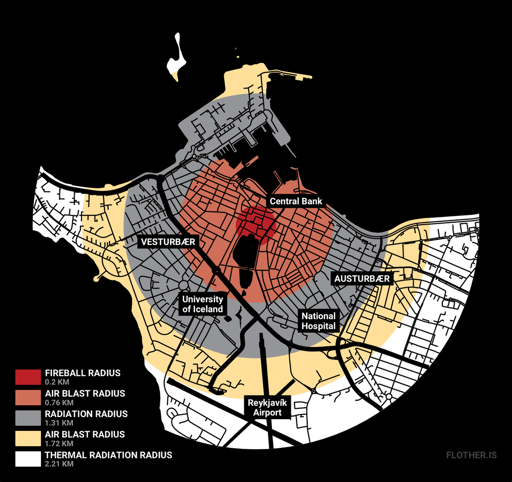
What impact would the Fat Man atomic bomb, dropped on Nagasaki in 1945, have on modern-day Reykjavík?
Just over 73 years ago, after three failed bombing runs over the city of Kokura, the United States dropped a nuclear bomb on the Japanese city of Nagasaki. With the codename Fat Man, the bomb killed at least 40,000 people and destroyed everything within a one-mile radius of the explosion. Amazingly, because the bomb was dropped into a valley, a large part of the city was protected by hills. The death and destruction could have been even worse.
Still, it can be hard to visualise quite how bad this destruction was. In 2015, on the 70th anniversary of the end of the Second World War, the South China Morning Post published an infographic showing the impact the Fat Man bomb would have on modern cities. For Hong Kong and 20 other cities it shows where the plutonium bomb would have demolished buildings and killed or injured the modern population.
The infographic isn’t without its flaws — the most glaring being the colour scheme, unsuitable for sequential data such as this — but it is quite arresting. What if it were my city? What would it look like if Fat Man had been dropped on modern Reykjavík?
Using data from Landmælingar Íslands, the national mapping agency of Iceland, and Landupplýsingakerfi Reykjavíkur, the City of Reykjavík’s GIS department, I made a version of the map in R using the sf package and the Tidyverse. The map makes Alþingi, Iceland’s national parliament, the surface point directly beneath the nuclear airburst. Almost all government ministries are within the affected area.
Seventy years later, the world is still not free of nuclear weapons. Nine countries control more than 15,000 nuclear weapons and the United States and Russia keep weapons many times more powerful than Fat Man on high-alert.