Landmælingar Íslands
The 3 pages that I, in my great wisdom, have decided have something to do with ‘Landmælingar Íslands’. Whatever that is
-
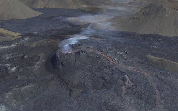
Making a high-resolution 3D map of the Geldingadalsgos volcanic eruption
Maps
Open data and open-source tools combine to make a detailed model of Iceland’s newest land
-
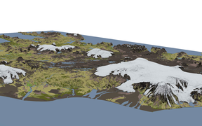
A 3D terrain map of Iceland using Three.js and GDAL
Maps
Playing with open data and open-source libraries to make a three-dimensional terrain map of Iceland
-
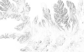
Shaded relief map of Iceland
Maps
What would Iceland look like if we could only see the shadows of its mountains?