Wind farms across Scotland
Maps
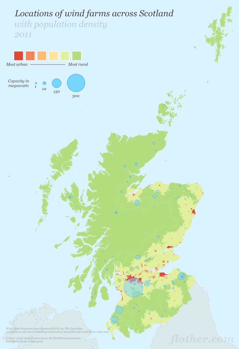
Locations of wind farms across Scotland, overlaid on top of the Scottish Government’s urban–rural classification.
The size of the blue circles indicates the megawatt capacity of each wind farm, not the actual size of the farm itself. I hope that was obvious.
Data taken from The Guardian and the Scottish Government.
Update
As pointed out by ‘Caithnessian’ in the comments under the original Guardian article, the data there is out-of-date. So I found the latest (July 2011) data from Scottish Natural Heritage and busied myself with creating a zoomable map showing the outlines of all the wind farms — proposed or installed — in Scotland.