Maps
The 19 pages that I, in my great wisdom, have decided have something to do with ‘Maps’. Whatever that is
-
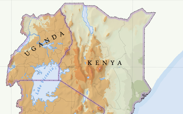
A map of Lake Victoria, in a traditional atlas style
Maps
My own attempt at making an atlas-style map showing the political boundaries and elevation of Kenya, Tanzania, and Uganda
-
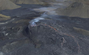
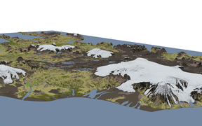
Making a high-resolution 3D map of the Geldingadalsgos volcanic eruption
Maps
Open data and open-source tools combine to make a detailed model of Iceland’s newest land
-
Já’s new map: switching from raster to vector
Maps
In a talk I gave to LÍSA, the Icelandic association for geographic information, I argue that we need to think about maps as software now
-
What if it were our city?
Maps
What impact would the Fat Man atomic bomb, dropped on Nagasaki in 1945, have on modern-day Reykjavík?
-
Access denied: using the Glasgow Subway by wheelchair
Maps
The subway can be the quickest way to get around a city. Unless you’re in a wheelchair
-
A 3D terrain map of Iceland using Three.js and GDAL
Maps
Playing with open data and open-source libraries to make a three-dimensional terrain map of Iceland
-
Shaded relief map of Iceland
Maps
What would Iceland look like if we could only see the shadows of its mountains?

-
From village to city: the evolution of Reykjavík
Maps
Using open data to track 140 years of growth in Iceland’s capital city
-
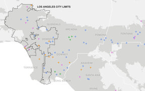
The Counted in southern California
Maps
People killed by police and other law enforcement agencies in and around Los Angeles
-
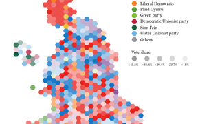
Who came second in the British general election?
Maps
Britain’s voters are more diverse than the election results suggest
-
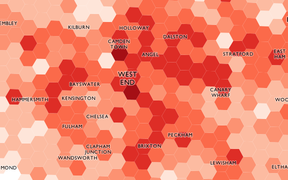
London: violent crime in 2012
Maps
Violent crime recorded in Britain’s capital city throughout the year
-
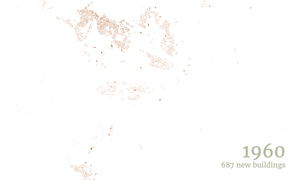
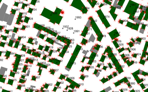
How I made the map of the buildings of Reykjavík
Maps
Every dataset is messy, and each is messy in its own way
-
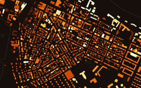
The Age of Greater Reykjavík
Maps
The age of buildings in Iceland’s capital city, dating back to the 18th century
-
What is famine?
Maps
How food shortages have come to be seen as a tragedy of the individual
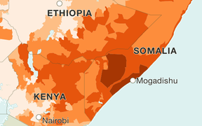
-
How did MPs vote on the gay marriage bill?
Maps
In February 2013, the House of Commons voted on same-sex marriage. Did the vote follow party lines?

-
Map of child poverty in England, Scotland, and Wales
Maps
District-level data from the Campaign to End Child Poverty
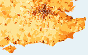
-
Edinburgh’s most photogenic locations
Maps
Where in Scotland’s capital are you most likely to take a photograph?
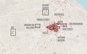
-
Wind farms across Scotland
Maps
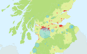
-
The world’s top 100 universities, visualised
Maps
See how the world’s best institutions compare